File:OTI-indicators-mapped.png
Jump to navigation
Jump to search
The printable version is no longer supported and may have rendering errors. Please update your browser bookmarks and please use the default browser print function instead.
No higher resolution available.
OTI-indicators-mapped.png (580 × 416 pixels, file size: 328 KB, MIME type: image/png)
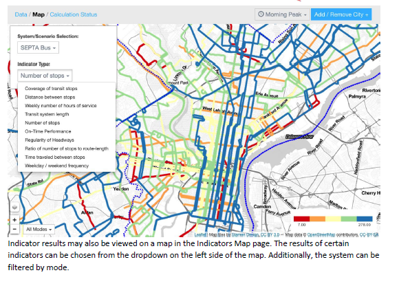
The stop density indicator mapped onto routes
File history
Click on a date/time to view the file as it appeared at that time.
| Date/Time | Thumbnail | Dimensions | User | Comment | |
|---|---|---|---|---|---|
| current | 23:18, 6 April 2017 | | 580 × 416 (328 KB) | Leeor (talk | contribs) |
You cannot overwrite this file.
File usage
The following page uses this file: