File:OTI-indicators-mapped.png
Jump to navigation
Jump to search
No higher resolution available.
OTI-indicators-mapped.png (580 × 416 pixels, file size: 328 KB, MIME type: image/png)
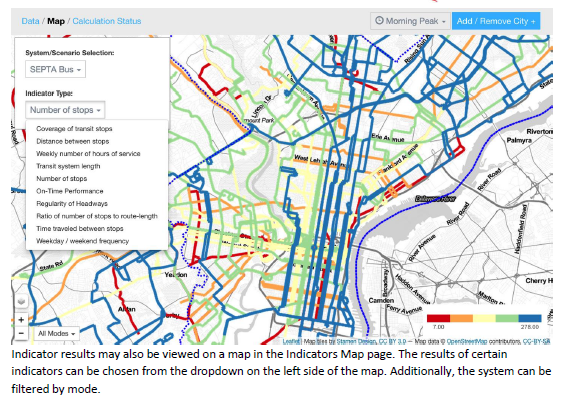
The stop density indicator mapped onto routes
File history
Click on a date/time to view the file as it appeared at that time.
| Date/Time | Thumbnail | Dimensions | User | Comment | |
|---|---|---|---|---|---|
| current | 23:18, 6 April 2017 | | 580 × 416 (328 KB) | Leeor (talk | contribs) |
You cannot overwrite this file.
File usage
The following page uses this file: