Difference between revisions of "File:Livabilityvision.png"
Jump to navigation
Jump to search
Rabiabonour (talk | contribs) (This land use diagram for Las Vegas's North Fifth Street Corridor Plan is an example of the type of document that can be developed during the visioning process. Source: [http://www.trb.org/Publications/Blurbs/174953.aspx Transit Cooperative Research Bo...) |
(No difference)
|
Latest revision as of 22:49, 11 November 2016
This land use diagram for Las Vegas's North Fifth Street Corridor Plan is an example of the type of document that can be developed during the visioning process. Source: Transit Cooperative Research Board
File history
Click on a date/time to view the file as it appeared at that time.
| Date/Time | Thumbnail | Dimensions | User | Comment | |
|---|---|---|---|---|---|
| current | 22:49, 11 November 2016 | 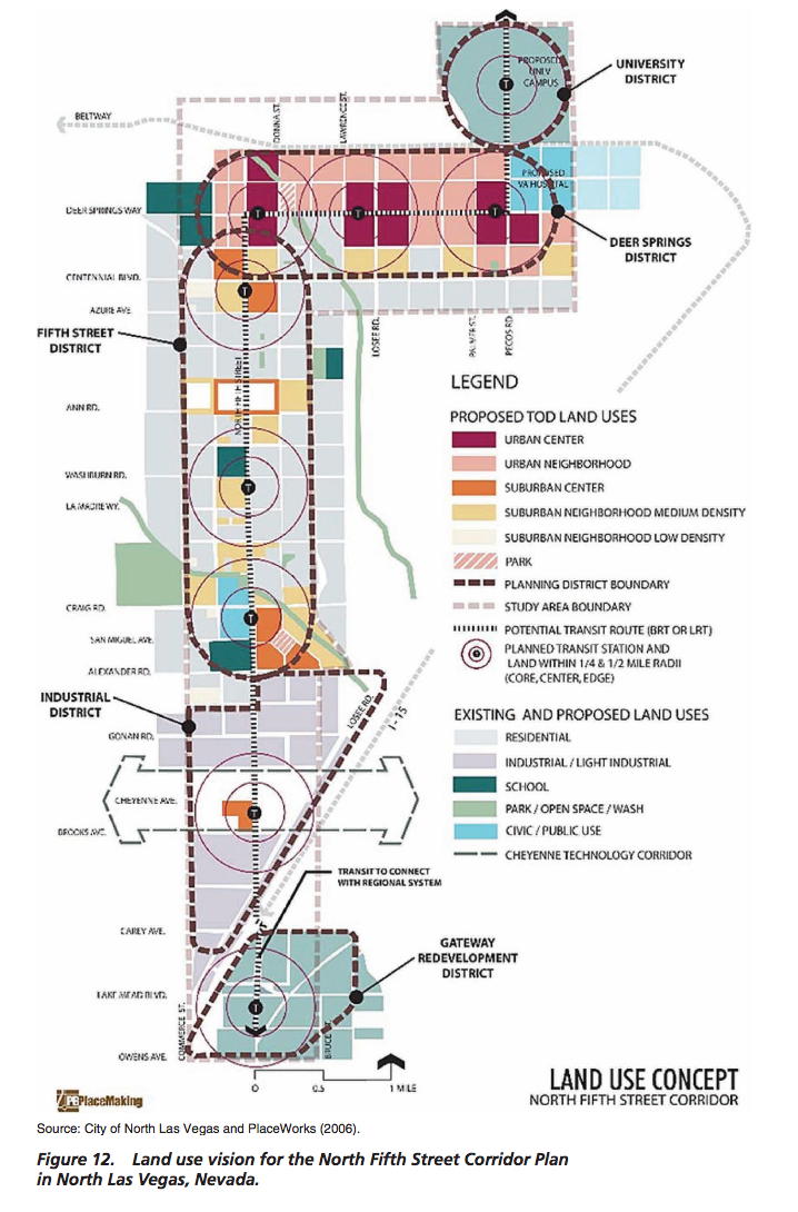 | 718 × 1,090 (783 KB) | Rabiabonour (talk | contribs) | This land use diagram for Las Vegas's North Fifth Street Corridor Plan is an example of the type of document that can be developed during the visioning process. Source: [http://www.trb.org/Publications/Blurbs/174953.aspx Transit Cooperative Research Bo... |
You cannot overwrite this file.
File usage
The following page uses this file: